What Exactly is a Chenier?
The term “chenier” (pronounced shen-ear) comes from the Cajun French word “chêne”, meaning oak tree. Early settlers in Louisiana noticed that hardy, water-tolerant oak trees preferentially grew on these elevated, well-drained ridges, making them stand out from the soggy marshes and prairies around them. The name stuck, and it perfectly captures their essence as habitable islands in a sea of wetlands.
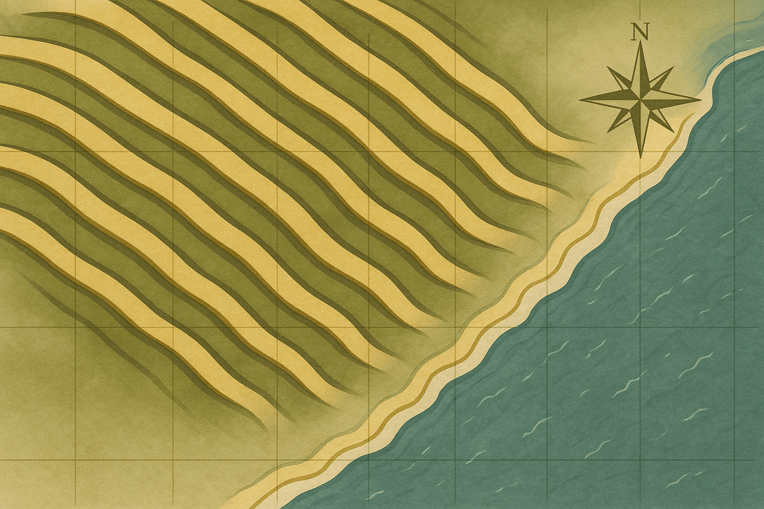
Geologically, a chenier is an elongated ridge composed of sand, shell fragments, and sometimes gravel. These ridges are typically a few meters high, tens to hundreds of meters wide, and can stretch for tens of kilometers, always running parallel to the coast. They are the coarse-grained, wave-reworked remnants of a shoreline, marking a specific moment in the coastline’s past.
What makes a Chenier Plain so remarkable is the pattern: it’s not just one ridge, but a series of them separated by wide, low-lying tracts of muddy or marshy ground. This alternating pattern of ridge-and-swale is the key to understanding their formation.
The Dance of Mud and Waves: How a Chenier Plain is Built
Chenier Plains don’t form on just any coast. They require a specific set of ingredients: a low-gradient coastal plain, a nearby source of massive amounts of sediment (like a major river delta), and the right amount of wave energy. Their creation is a dynamic, two-step process driven by fluctuations in sediment supply from the river.
Phase 1: Progradation (The Coast Builds Out)
It all starts with the river. When a large river is in a high-discharge phase, it carries an enormous volume of fine sediment—silt and clay—to the sea. This sediment-laden water spreads out, and the fine particles settle on the nearshore seafloor. So much mud is deposited that it overwhelms the waves, and the coastline rapidly builds seaward. This process is called progradation. The result is a vast, muddy tidal flat, and the shoreline advances, sometimes by several meters a year.
Phase 2: Reworking and Ridge Formation (The Coast Retreats and Sorts)
The river’s sediment supply is not constant. A river might naturally shift its course to a new channel (a process called avulsion), or a prolonged drought might reduce its flow. When the sediment tap is turned down, the dynamic at the coast changes dramatically. Without a fresh supply of mud to buffer them, the waves begin to dominate. They attack the newly formed mudflat, winnowing away the fine silts and clays and carrying them offshore.
What’s left behind? The heavier, coarser materials: sand and shells. The persistent action of the waves rolls and pushes this coarser sediment landward, piling it up at the high-tide line to form a distinct, linear ridge—the chenier. During this phase, the coastline may actually retreat slightly as the waves rework the existing land.
This cycle then repeats itself. The river might shift its course back, or rainfall patterns might change, and a new pulse of mud arrives at the coast. A new mudflat builds out in front of the recently formed chenier. When the sediment supply wanes again, a new chenier will form at the new shoreline. Over thousands of years, this cyclical process creates a series of parallel cheniers, each separated by the muddy plains that formed during times of high sediment supply.
A Library of Coastal History
Because of this formation process, a Chenier Plain is a fantastic chronological map of coastal change. The ridge furthest inland is the oldest, marking a long-abandoned shoreline. The ridge closest to the sea is the youngest. The muddy plains in between represent periods of rapid delta growth.
By studying these ridges, scientists can unlock a wealth of information:
- Dating: Using radiocarbon dating on the shells within a chenier, researchers can determine exactly when that ridge was formed. This allows them to create a precise timeline of the river’s behavior and the coastline’s movement.
- River History: The sequence tells a story about the associated river delta. A dense cluster of cheniers might indicate a period when the river’s channel was unstable and frequently shifted, causing many fluctuations in sediment supply.
- Sea-Level Change: The elevation and composition of the ridges can provide clues about past sea levels and storm intensity.
Where in the World Are Chenier Plains?
Chenier Plains are a rare but global phenomenon, found wherever the right conditions exist. Some of the most significant examples include:
- Louisiana, USA: The “Chenier Plain” of southwestern Louisiana and southeastern Texas is the type locality. It records the history of the Mississippi River switching its delta lobes over the last 5,000 years.
- The Guianas Coast, South America: The coast of Suriname, Guyana, and French Guiana is home to a spectacular chenier plain, fed by sediment that travels northwest from the mouth of the mighty Amazon River.
- Bohai Bay, China: The delta of the Yellow River (Huang He), famous for carrying the world’s highest sediment load, has built an extensive chenier plain.
- Gulf of Carpentaria, Australia: The coastline here features a well-developed chenier system, providing a record of Holocene environmental changes in the region.
Humanity’s Foothold on the Coast
For millennia, these ridges have been vital to human life. In a flat, wet world, a chenier is high ground. It’s a natural levee, offering protection from minor flooding and a stable foundation for settlement. They are the natural corridors for roads, keeping them above the seasonal floods of the marsh. In Louisiana, for instance, many communities and highways are built directly on top of these ancient ridges, following their gentle, curving paths.
These ridges also create crucial ecological boundaries, separating freshwater marshes from saltwater tidal flats and supporting unique ecosystems. However, these landforms are incredibly vulnerable. Starved of new sediment by upstream dams on rivers and facing accelerated sea-level rise and more intense storms, many of the world’s Chenier Plains are now eroding. The very landforms that record thousands of years of coastal history are at risk of being washed away, taking with them the communities and ecosystems they support.
So the next time you see a map of a deltaic coast, look for those strange, parallel lines. They are more than just ridges of sand and shell; they are the pages in a geological storybook, telling a tale of the epic, ongoing dance between rivers, waves, and time.