Imagine flying over the countryside of upstate New York, western Ireland, or southern Ontario. Below you, the landscape isn’t flat, nor is it randomly rumpled with hills. Instead, it’s covered in a vast swarm of smooth, elongated, parallel hills, all pointing in the same direction. From above, it looks uncannily like someone has scattered a giant’s collection of eggs across the land. This remarkable sight is known as a “basket of eggs topography”, and each one of those “eggs” is a geological marvel known as a drumlin.
These are not ordinary hills. They are the direct, sculpted footprints of glaciers, a physical memory of a time when immense sheets of ice, thousands of feet thick, crept across the continents. Drumlins tell a dramatic story of immense pressure, geological sculpting, and the slow, unstoppable power of an Ice Age.
What is a Drumlin?
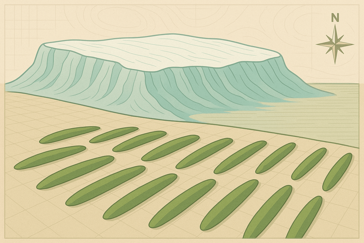
At its core, a drumlin (a word derived from the Irish droimnín, meaning “little ridge”) is an elongated, teardrop-shaped hill composed primarily of glacial till. Glacial till is the jumbled, unsorted mixture of clay, sand, gravel, and boulders that a glacier picks up, transports, and deposits.
A classic drumlin has several distinct features that act as clues to its formation:
- Shape: Asymmetrical and streamlined. They are blunt and steep on one end and long and gently tapering on the other.
- The Stoss End: This is the steeper, blunter end of the drumlin. It faces upstream, pointing toward the direction from which the glacier advanced.
- The Lee Side: This is the longer, gently sloping, tapered end. It points downstream, in the direction the ice was flowing.
- Composition: While most are made of till, some drumlins have a core of bedrock or older, more resistant sediment that acted as an anchor point for the till’s deposition.
- Size: Drumlins vary in size but typically range from 15 to 50 meters (about 50 to 160 feet) in height and can be up to a kilometer (over half a mile) long.
Forged Under Pressure: The Birth of a Drumlin
One of the most fascinating aspects of drumlins is that they were not simply dumped by a melting glacier. They were actively shaped and streamlined beneath the moving ice sheet. While geologists still debate the exact mechanics, the most widely accepted theory is one of subglacial deformation and deposition.
Picture a massive continental glacier, a river of ice flowing under its own immense weight. The base of this glacier isn’t clean ice; it’s a thick, slurry-like layer saturated with rock debris and meltwater.
The formation process likely begins when the glacier flows over a small obstacle on the ground. This could be a resistant knob of bedrock or a patch of older, heavily compacted till that is harder to move.
- Obstruction and Plastering: As the ice encounters this obstacle, the flow is disrupted. The pressure on the upstream side (the stoss side) increases dramatically, squeezing and compressing the water-logged till at the glacier’s base. This immense pressure effectively plasters sediment onto and against the obstacle, building up the steep, blunt end of the drumlin.
- Streamlining and Deposition: As the ice flows over the newly formed hump, a low-pressure cavity can form on the downstream side (the lee side), similar to the slipstream behind a fast-moving vehicle. In this zone of lower pressure, the glacier is less able to hold onto its sediment load. The till is deposited and stretched out, forming the long, tapered, and streamlined tail.
This process is repeated over and over as the glacier continues its slow but relentless advance, sculpting the entire hill into its final, aerodynamic, teardrop shape. Every drumlin is, therefore, a perfect cast of the ice flow conditions at its base.
Reading the Ice: Drumlins as Glacial Weathervanes
Because their orientation is dictated by the movement of the ice that formed them, drumlins are invaluable tools for geologists. They are giant arrows carved into the land, pointing the way of ancient ice flow. By mapping the orientation of thousands of drumlins in a field, scientists can reconstruct, with incredible accuracy, the movement patterns of the massive Laurentide and Scandinavian ice sheets that covered North America and Europe during the last Ice Age.
The stoss-and-lee shape is an unambiguous indicator: the steep end points to where the ice came from, and the gentle slope points to where it was going.
Global Drumlins: A Basket of Eggs Topography
Drumlins rarely occur in isolation. They almost always appear in large groups, known as drumlin fields or swarms, creating the distinctive “basket of eggs” landscape. Some of the world’s most impressive drumlin fields include:
- Clew Bay, County Mayo, Ireland: Perhaps the most picturesque example, Clew Bay is a “drowned” drumlin field. After the glaciers retreated, sea levels rose, partially submerging the field. Today, the bay is famously said to have 365 islands—one for every day of the year—each one the peak of a waterlogged drumlin.
- Upstate New York, USA: The region between Rochester and Syracuse is home to one of the largest drumlin fields in the world, with an estimated 10,000 drumlins sculpted by the Laurentide Ice Sheet. The famous Hill Cumorah of Mormon history is a prominent drumlin in this field.
- Wisconsin, USA: The state is famous for its glacial geology, and the landscape across its eastern half is dominated by extensive drumlin swarms, providing classic textbook examples.
- Canada: Vast drumlin fields cover parts of Ontario, Quebec, and the prairie provinces, all remnants of the same colossal ice sheet that covered New York.
Living on the Footprints
These glacial landforms have profoundly influenced human geography for millennia. The well-drained, gravelly soil of the drumlins themselves often provided better land for agriculture and settlement than the boggy, marshy ground in the low-lying areas between them.
Look at a map of a drumlin field, and you’ll often see roads, farms, and even towns preferentially built along the ridges of the drumlins to stay on solid, dry ground. The original core of Boston, Massachusetts, including its famous Beacon Hill, was built upon a cluster of drumlins. In a drumlinized landscape, transportation routes often wind and curve, not to avoid steep mountains, but to navigate the gentle yet persistent undulations of the drumlin swarm.
Today, these ancient hills are more than just geographical curiosities. They are a tangible link to our planet’s recent icy past. The next time you see a landscape of rolling, elongated hills, take a moment. You might not just be looking at a hill, but at the carefully sculpted footprint of a glacier, a silent monument to the awesome, world-shaping power of ice.