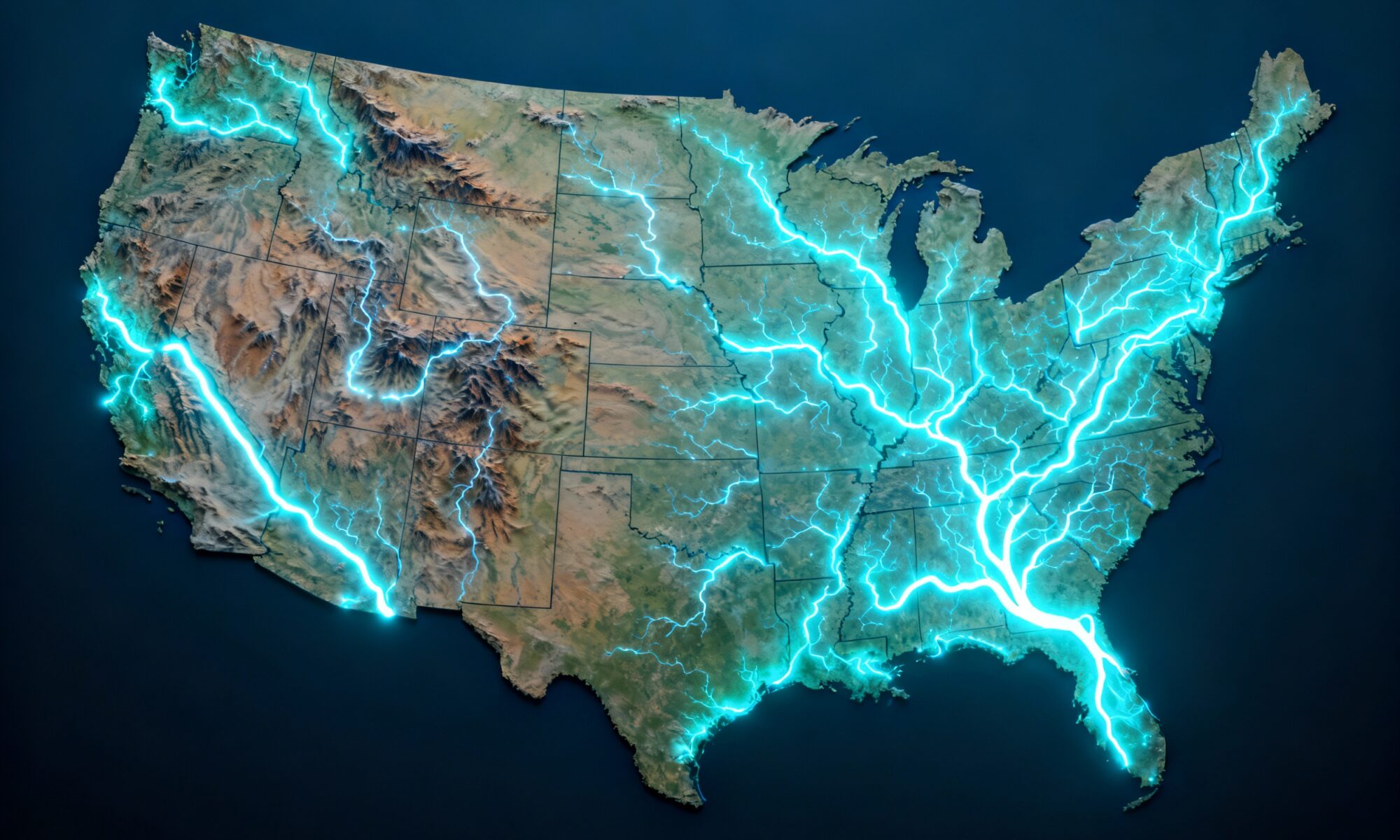
Look at a map of the United States. Your eyes will likely trace two distinct types of lines. First, there are the ruler-straight, geometric borders of states like Colorado and Wyoming—products of surveyors and politics. But then there are the others: the jagged, meandering lines that twist and turn with an organic logic. More often than not, these lines are not lines at all. They are rivers.
Long before interstates and railways, rivers were the arteries of North America. They were the first highways, the most logical place for trade, and the most obvious way to define territory. The story of America’s growth—its exploration, settlement, and economic might—is inextricably linked to the flow of its great rivers. They didn’t just carry water; they carried people, goods, and ideas, and in the process, they drew the map of a nation.
Liquid Borders: Drawing Lines on the Water
For early mapmakers and politicians, rivers were a convenient and seemingly permanent way to delineate territory. They were unmistakable physical features in a vast and often un-surveyed wilderness. This practice had profound consequences that still shape American society today.
The Ohio River: A Line Between Ideologies
The Ohio River, whose name is derived from an Iroquoian word for “Great River,” served as more than just a geographic boundary; it was an ideological one. The Northwest Ordinance of 1787, a foundational document of American expansion, prohibited slavery in the territory north of the Ohio River. As a result, the river became the stark dividing line between the free states of Ohio, Indiana, and Illinois to the north, and the slave-holding states of Kentucky and (later) West Virginia to the south. For thousands of enslaved people, crossing the Ohio meant a dangerous journey toward freedom, making its banks a critical corridor of the Underground Railroad.
The Mississippi River: The Great Divider
If the Ohio was a regional divider, the Mississippi was the continental one. This “Father of Waters” carves a massive north-south path through the heart of the country, creating the entire western border for Tennessee and Mississippi, and the eastern border for Arkansas, Missouri, and Iowa. Thomas Jefferson’s vision of an “Empire of Liberty” was predicated on American control of this river. Securing access to its mouth at New Orleans was the primary driver behind the 1803 Louisiana Purchase, an acquisition that doubled the size of the young country and opened the floodgates of westward expansion.
But rivers are not static. They flood, shift, and carve new channels. This has led to fascinating geographical and legal quirks. The town of Kaskaskia, for example, was once the capital of the Illinois Territory, situated safely on a peninsula. But in 1881, a massive flood caused the Mississippi to jump its banks and carve a new channel east of the town. Today, Kaskaskia, Illinois, is geographically isolated, accessible by land only by crossing a bridge from Missouri. The river moved, but the border, by law, did not.
Cities Born at the Confluence
Human geography is often a story of strategic location, and in a river-based world, nowhere was more strategic than a confluence—the point where two or more rivers meet. These junctions became natural hubs for trade, defense, and settlement, giving rise to some of America’s most important inland cities.
- Pittsburgh, Pennsylvania: Located where the Allegheny and Monongahela rivers join to form the mighty Ohio, Pittsburgh was the “Gateway to the West.” Control of this point (then known as Fort Duquesne) was a major flashpoint of the French and Indian War. Its location ensured it would become an industrial powerhouse, sending iron, steel, and coal downriver to build a growing nation.
- St. Louis, Missouri: Nestled just south of the confluence of the two greatest rivers on the continent—the Mississippi and the Missouri—St. Louis was destined for greatness. It became the command center for the American fur trade and the last major stop for pioneers heading west on the Oregon and Santa Fe trails. The city’s iconic Gateway Arch stands today as a monument to this pivotal role.
- New Orleans, Louisiana: While not a confluence city in the traditional sense, New Orleans’ power came from its command of the Mississippi Delta, the gateway to the Gulf of Mexico and the wider world. All the agricultural and commercial wealth of the vast Mississippi Basin had to float past its docks, making it one of the richest and most strategically vital cities in the 19th-century Americas.
From Transportation to Resource: The Arid West
While the rivers of the East and Midwest were primarily highways for commerce and settlement, the great rivers of the American West played a different, though equally crucial, role. In the vast, dry expanses west of the 100th meridian, water wasn’t just a path for a boat; it was life itself.
The Colorado River is the quintessential example. It slices through the desert, carving magnificent landscapes like the Grand Canyon. For centuries, it was more of an obstacle than a highway. But in the 20th century, it became the focus of one of the largest engineering projects in human history. Dams like the Hoover and Glen Canyon were built to tame its floods and, more importantly, to divert its water and generate hydroelectric power.
This reallocation of water drew a new kind of map. The growth of massive desert metropolises like Los Angeles, Phoenix, and Las Vegas would have been impossible without the water siphoned from the Colorado. Here, the river didn’t determine the location of a city at a confluence, but instead dictated the reach of agriculture and urban development hundreds of miles away. Its water, allocated by a complex series of laws and compacts known as the “Law of the River”, is now one of the most contested resources in the country, a testament to how crucial a single river can be to the survival of an entire region.
A Permanent Mark on the Map
Today, we cross rivers on massive steel bridges and fly over them at 30,000 feet, their role as our primary transportation corridors long since ceded to pavement and steel rails. Yet their influence is permanently etched into the American landscape. They are the reason ten states have “Mississippi” as a border, why Cincinnati became “Porkopolis” by shipping cured meat down the Ohio, and why a small piece of Illinois lies west of the nation’s largest river.
The next time you look at a map, pay closer attention to those crooked, natural lines. They aren’t just geographic features; they are the foundational strokes in the portrait of a nation, a story of how the powerful, persistent flow of water drew the United States.