Imagine waking up one morning to find the river that separates your country from its neighbor has jumped its banks overnight. After a torrential flood, the water now carves a new path a mile to the south, placing your farm, your home, and your town squarely on the other side of the border. Are you now a citizen of another nation? Does your government lose a chunk of its territory? This is not a far-fetched thought experiment; it’s a very real geographical phenomenon known as river avulsion, and it has been a source of geopolitical chaos, legal head-scratching, and human drama for centuries.
The Fickle Nature of River Boundaries
Rivers seem like the perfect natural borders. They are clear, visible lines on a map that are difficult to cross, providing a seemingly permanent demarcation between two sovereign states. But the reality is that rivers are dynamic, living systems. Their paths are not fixed. This is where a crucial legal and geographical distinction comes into play:
- Accretion: This is the slow, gradual process where a river deposits sediment on one bank (accretion) and erodes the other. Under international law, when a boundary river changes by accretion, the border moves with it, typically following the thalweg—the line of the deepest or fastest-flowing part of the channel.
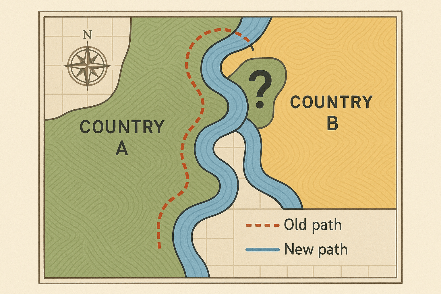
- Avulsion: This is the dramatic event we imagined earlier. It’s a sudden, rapid, and observable shift in a river’s course, often caused by a major flood. The river abandons its old channel for a new one. Crucially, the legal principle of avulsion states that the international boundary does not move. It remains fixed along the centerline of the old, abandoned riverbed.
While the legal theory seems clear, the reality on the ground is anything but. The distinction between a series of fast accretions and a single, sudden avulsion can be blurry, leading to disputes that last for decades.
The Rio Grande: A Century of Shifting Sands
Nowhere is the story of avulsion more prominent than along the U.S.-Mexico border. The 1848 Treaty of Guadalupe Hidalgo established the Rio Grande (or Río Bravo, as it’s known in Mexico) as the boundary. But the Rio Grande is a classic meandering river, prone to wild swings and floods, setting the stage for endless complications.
The Chamizal Dispute: A Neighborhood Adrift
The most famous case is the Chamizal Dispute. In 1864, a massive flood dramatically shifted the Rio Grande southward near El Paso, Texas, and Ciudad Juárez, Mexico. A tract of about 600 acres of Mexican territory, known as the Chamizal, was suddenly on the north side of the river. According to the avulsion principle, it should have remained part of Mexico.
However, the United States argued the shift was gradual and claimed the land. What followed was nearly a century of diplomatic stalemate. An international arbitration commission in 1911 sided mostly with Mexico, but the U.S. rejected the ruling. The detached land became an urbanized part of El Paso. Finally, in 1963, Presidents John F. Kennedy and Adolfo López Mateos signed the Chamizal Convention, formally returning the majority of the disputed territory to Mexico.
The resolution was an incredible feat of engineering and diplomacy. A 4.3-mile concrete channel was built to permanently fix the river’s course. Bridges had to be rebuilt, and thousands of residents and businesses on both sides were relocated. The Chamizal story is a powerful testament to how a single flood can create a diplomatic crisis that takes 100 years to resolve.
The Bizarre Case of Rio Rico
An even stranger tale unfolded further downriver. In 1906, an unauthorized dredging project by an American land company caused the Rio Grande to cut across the neck of a U-shaped bend, stranding a 419-acre parcel of U.S. territory—the Horcón Tract—on the Mexican side of the river.
For decades, this geographical anomaly was forgotten. A town called Rio Rico grew up on the tract. Its residents paid U.S. taxes, had U.S. birth certificates, voted in U.S. elections, and served in the U.S. military. Yet, legally, they were living on a piece of land surrounded by Mexico but governed by the United States. In the 1970s, the U.S. government officially “rediscovered” the anomaly. After investigating, it determined that because the river’s shift was artificial and abrupt, it was an avulsion, and the land remained U.S. territory. In 1977, the border was finally adjusted by treaty to reconnect Rio Rico with the rest of Texas, ending its bizarre status as a “lost” American town.
From Legal Disputes to All-Out War: The Shatt al-Arab
While U.S.-Mexico disputes were eventually solved with treaties and concrete, river avulsion and boundary disagreements can have far more violent consequences. The Shatt al-Arab waterway, formed by the confluence of the Tigris and Euphrates rivers, serves as the border between Iran and Iraq before flowing into the Persian Gulf.
For decades, Iraq claimed sovereignty over the entire waterway, with the border on the Iranian bank. In the 1975 Algiers Agreement, Iraq conceded to set the border along the thalweg in exchange for Iran ending its support for Kurdish rebels. However, five years later, in a move that would trigger a devastating conflict, Iraqi leader Saddam Hussein tore up the treaty on television, reasserted Iraq’s claim to the entire waterway, and launched a full-scale invasion of Iran. The dispute over control of the Shatt al-Arab was a primary cause of the Iran-Iraq War, a conflict that lasted eight years and resulted in over a million casualties.
Managing a Moving Border in the 21st Century
Today, countries are better equipped to handle these issues. Modern joint commissions, like the U.S.-Mexico International Boundary and Water Commission (IBWC), actively monitor and manage boundary rivers. GPS, satellite imaging, and precise surveying allow for the exact demarcation of borders, even if the river underneath them shifts.
Yet the fundamental forces of nature remain. Climate change promises more extreme weather events, which could increase the frequency of major floods and avulsion events worldwide. Rivers that have been stable for decades could suddenly spring to life, redrawing the map and testing the stability of international agreements.
River avulsion is a stark reminder that the lines we draw on our world are often not as permanent as we believe. They are subject to the immense power of physical geography—a power that can, in a single day, reshape not only the land but also the destinies of the people who live on it.