The hinterland is the invisible economic territory that a port dominates. It’s the inland region from which it draws exports and to which it distributes imports. This is not a line drawn on a political map but a fluid boundary defined by cost, time, and infrastructure. The battle for global trade isn’t just fought at sea; it’s a constant, silent war for logistical control over these vast inland empires.
The Anatomy of a Hinterland
A hinterland is shaped by two powerful forces of geography: the physical and the human.
Physical geography lays the foundation. A wide, navigable river is a natural superhighway into a continent’s interior. A mountain range is a formidable wall. The very location of a port at the mouth of a river or in a sheltered deep-water bay is a gift of geology and hydrology. For centuries, these natural features dictated the extent of a port’s reach.
But today, human geography—the infrastructure we build—is arguably more important. A well-placed network of highways, dedicated freight railways, and inland canals can overcome physical barriers and radically reshape a port’s domain. These man-made arteries are what allow a port to project its influence hundreds, even thousands, of miles inland, creating a “captive” area where it is the most efficient and cost-effective gateway to the world.
Case Study: Rotterdam and the Conquest of Europe
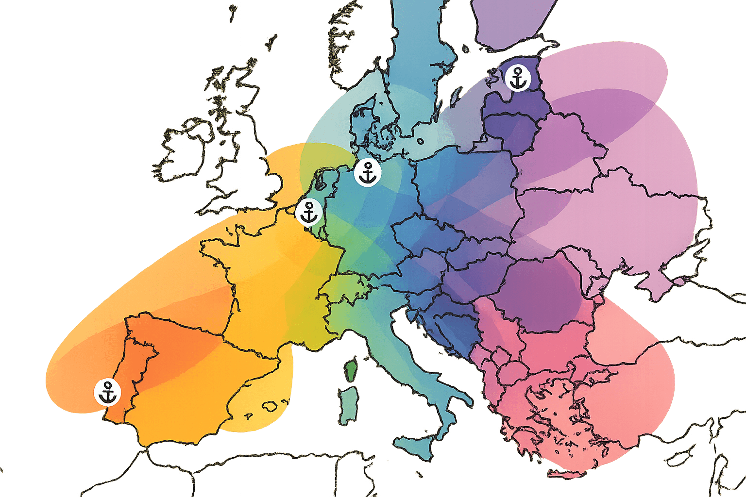
There is perhaps no better example of a port defined by its hinterland than the Port of Rotterdam in the Netherlands. Geographically, it sits in a supremely advantageous position at the mouth of the Rhine-Meuse-Scheldt river delta. The Rhine, in particular, acts as a colossal conveyor belt, granting Rotterdam direct, low-cost water access deep into the industrial heart of Europe.
Cargo unloaded at Rotterdam can be placed on a barge and sent upstream, reaching the Ruhr Valley—Germany’s industrial powerhouse—as well as major economic hubs in France and Switzerland. This natural advantage makes Rotterdam the logical gateway for a huge swathe of the European continent. Its hinterland is one of the wealthiest and most productive on Earth.
But Rotterdam doesn’t rest on its geographical laurels. It actively expands its hinterland through human ingenuity. The Dutch have invested heavily in the Betuwe Route, a 160-kilometer dedicated freight-only railway connecting the port directly to the German border. This bypasses passenger traffic, increasing speed and reliability, and effectively pulling more of Germany’s economy into Rotterdam’s orbit. This constant investment is crucial because Rotterdam is in a fierce struggle with its neighbours, the ports of Antwerp (Belgium) and Hamburg (Germany), which are constantly trying to chip away at its hinterland by improving their own rail and road connections.
Case Study: Singapore, The Global Transshipment Hub
Not all hinterlands are contiguous landmasses. The Port of Singapore illustrates a different, yet equally powerful, concept: the maritime hinterland.
Singapore is a small island nation with no significant physical hinterland of its own. Its power comes from its unparalleled strategic location astride the Strait of Malacca, the chokepoint through which a third of all global shipping passes. Singapore leveraged this position to become the world’s premier transshipment hub.
The world’s largest container ships—the Ultra Large Container Vessels (ULCVs)—are too massive to call at smaller, shallower ports. They operate on major east-west trunk routes. Singapore’s function is to act as a giant sorting facility. A ULCV will arrive from Europe, unload thousands of containers, which are then quickly sorted and loaded onto smaller “feeder” vessels. These feeder ships then fan out across Southeast Asia, serving hundreds of smaller ports in Indonesia, Thailand, Vietnam, and Malaysia. In this model, Singapore’s hinterland isn’t a landmass but an entire maritime region. Its dominance is based on supreme efficiency, speed, and connectivity.
The Battle for the American Heartland
The geography of North America presents a fascinating battleground for competing hinterlands. The vast, productive interior of the continent—the Midwest—is a prize fought over by ports on three different coasts.
- The West Coast Ports: The twin ports of Los Angeles and Long Beach are the primary gateway for trade with Asia. Their hinterland is carved out by two massive rail networks, the BNSF and Union Pacific, whose steel rivers flow east to major hubs like Chicago, Dallas, and Memphis. A container of electronics unloaded in LA can be on a train and crossing the Rocky Mountains within hours.
- The East Coast Ports: Ports like New York/New Jersey and Savannah historically served transatlantic trade. However, the 2016 expansion of the Panama Canal was a game-changer. Now, larger ships from Asia can bypass the West Coast and sail directly to the East Coast, allowing these ports to compete for cargo destined for cities as far west as the Ohio Valley.
- The Gulf Coast Ports: Ports like Houston also vie for a piece of the pie, using their connections to serve the southern Midwest and leverage trade from Latin America.
For a company in Chicago, the choice of which port to use for its imports from Shanghai is a complex calculation of time, cost, and reliability. This creates what geographers call a “contested hinterland” or “hinterland overlap”, where the invisible economic boundaries of these great ports blur and shift with every change in fuel prices, rail schedules, and trade policies.
Mapping the Invisible World
A port’s hinterland is a living, breathing entity. A new trade agreement can open a market, expanding a hinterland overnight. A new high-speed rail line can slice days off transit time, stealing territory from a rival. A strike at one port can temporarily divert cargo, giving a competitor a chance to prove its efficiency and permanently capture new business.
Understanding these invisible territories is to understand the true geography of our globalized economy. The price of the coffee in your cup, the parts in your car, and the phone in your hand are all influenced by these silent battles for logistical dominance fought deep within our continents, far from the ocean’s edge.