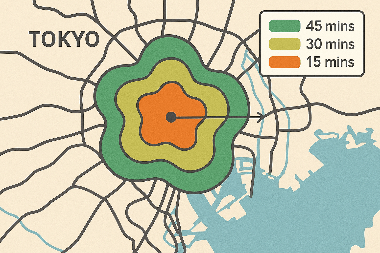
Forget the simple circles you’d draw with a compass. An isochrone map visualizes something far more complex and human: how far you can travel from a single point, in every direction, within a specific timeframe. The result isn’t a neat circle, but a sprawling, organic shape that reveals the true circulatory system of a place.
What Exactly is an Isochrone Map?
The name itself offers a perfect clue. It comes from the Greek roots iso, meaning “equal”, and chronos, meaning “time.” An isochrone map, therefore, is a map of equal time. It delineates the boundary of reachability from a starting point for a given travel time.
Imagine you’re standing in the center of a city and want to know everywhere you can get to within a 15-minute walk. A simple distance-based map would draw a circle with a radius of, say, three-quarters of a mile. But you can’t walk through buildings or across rivers without bridges. An isochrone map understands this. It would trace out along the actual street grid, showing you a “blob” of accessibility that stretches further along straight, open avenues and gets cut short by parks, industrial zones, or highways you can’t cross on foot.
You can create isochrones for any mode of transport:
- Walking: Often shows a detailed, web-like pattern following pedestrian paths and sidewalks.
- Cycling: Will stretch further and prioritize bike lanes and flatter terrain.
- Driving: Creates long tendrils along motorways and major arteries, but shrinks dramatically in congested city centers.
- Public Transport: Produces a unique, starburst pattern, with accessibility exploding around train stations and major bus routes.
The Real World in a Map: How They Work
Creating an isochrone map is a data-intensive process that goes far beyond a simple “as the crow flies” measurement. It requires a sophisticated understanding of a location’s network.
First, you need a starting point—an office, a hospital, a home. Next, you need a detailed network map. For driving, this is the road network, complete with speed limits, turn restrictions, one-way streets, and even real-time or historical traffic data. For public transport, it’s a web of train lines, bus routes, and tramways, including schedules, transfer times, and walking time to and from the stations.
An algorithm then calculates all possible paths outward from the starting point, “spending” its time budget along the way. The final shape represents the outer limit of that budget. This intricate calculation is why isochrone maps look so organic; they are a direct visual representation of how infrastructure either helps or hinders our movement.
Applications: How Isochrones are Shaping Our World
While fascinating on their own, isochrone maps are far from a geographical novelty. They are powerful analytical tools that are actively reshaping decision-making in critical sectors of our society.
Revolutionizing Urban Planning
For city planners, isochrones are a lens for equity and efficiency. By mapping accessibility, they can answer crucial questions:
- Public Service Access: Can every resident reach a fresh food market within a 20-minute bus ride? How large an area can a new fire station cover within a critical 5-minute response time? Isochrones help identify “service deserts” and guide the placement of new public facilities.
- Transport Equity: A planner can overlay a 30-minute public transport isochrone from a major employment hub onto a map of low-income neighborhoods. If the neighborhoods fall outside the isochrone, it’s a clear sign that the transport network is failing a key part of the population.
- Green Space Accessibility: Is there a park or public square within a 10-minute walk for most residents? This “walkability” metric is a key indicator of a neighborhood’s health and livability.
Reshaping Real Estate
The old mantra was “location, location, location.” The new mantra might as well be “commute, commute, commute.” Isochrones are becoming indispensable in real estate for both agents and buyers.
A homebuyer can input their office address and immediately see all the residential areas that fall within their desired 45-minute commute by car or train. This instantly filters out impossible options and reveals hidden gems they might not have considered. For sellers and developers, a property’s value is directly tied to its time-based proximity to amenities. Being inside the 15-minute walking isochrone of a popular school, a vibrant downtown, or a subway station can add tens of thousands of dollars to a property’s value.
Optimizing Logistics and Business
In the world of commerce, time is money. Isochrones provide a clear-eyed view of a business’s operational landscape.
- Delivery Zones: That “30-minute delivery” promise from your favorite pizza place or grocery app isn’t based on a simple circle. It’s an isochrone, calculated to ensure the company can meet its promise profitably and reliably.
- Site Selection: Where should a company open a new office to attract the largest possible talent pool? By creating isochrones from potential sites, they can analyze how many qualified workers live within a reasonable commute.
- Retail Analysis: A coffee shop owner can map the 5-minute walking isochrone around their store to understand their core customer base and a 10-minute driving isochrone to understand their wider market reach.
A New Way of Seeing
The true power of the isochrone map is its ability to shift our perspective. It moves us away from the abstract, inhuman measurement of distance and toward the lived, felt reality of time. It shows us that two points three miles apart can be “closer” than two points just one mile apart, all because of a well-placed highway or a missing bridge.
By visualizing time, we see the barriers and corridors that define our daily journeys. We see the invisible walls created by poor public transport and the gateways opened by smart infrastructure. In a world that moves faster every day, the isochrone map is not just a tool for geographers—it’s an essential guide for anyone hoping to build a more connected, efficient, and equitable world.