Walk into almost any classroom, and you’ll see it hanging on the wall: the Mercator projection. It’s the world map we all know, and for geography enthusiasts, the one we all love to criticize. We point out how Greenland, at 2.2 million square kilometers, looks as large as Africa, which is a staggering 30.4 million square kilometers. We decry its Eurocentric bias and its wild distortion of landmasses near the poles. It’s a “bad” map, we say. But what if this infamous map isn’t flawed, but is instead a work of genius designed for a single, world-changing purpose?
The secret lies not in the shapes of the continents, but in the lines drawn between them. The Mercator projection was never meant for classrooms; it was built for the storm-tossed deck of a 16th-century caravel. Its hidden tool, the feature that made it indispensable for centuries, is the rhumb line.
What Exactly Is a Rhumb Line?
Imagine you’re a ship’s captain in 1580. You have a magnetic compass, a chart, and a long, perilous journey ahead. Your most pressing need is to know which direction to steer. The simplest possible instruction is to maintain a single, constant compass bearing—say, 240° west-southwest—day after day.
This path of constant compass bearing is a rhumb line (also known as a loxodrome). On the curved surface of the Earth, a rhumb line is a spiral that winds towards the poles. If you were to follow a true east or west bearing (90° or 270°), you would trace a circle of latitude. If you follow any other constant bearing, you’ll spiral infinitely, getting ever closer to the North or South Pole without ever reaching it.
For an early navigator, the rhumb line was a godsend. It transformed the complex, three-dimensional problem of global navigation into a beautifully simple instruction: “Keep the needle on this mark.”
The Great Circle vs. The Rhumb Line: A Tale of Two Paths
Now, a geographer will correctly point out that a rhumb line is not the shortest distance between two points on the globe. That honor belongs to the great-circle route. A great circle is a line traced by a plane that passes through the center of the Earth. Think of the equator or any line of longitude—those are great circles. The flight path of an airplane from New York to Tokyo, arcing up over Alaska, is a classic example of a great-circle route.
So why wouldn’t sailors just use the shorter great-circle route? The answer is navigational complexity. To stay on a great-circle path, a ship must constantly change its compass bearing. Let’s look at a classic voyage from the Age of Discovery:
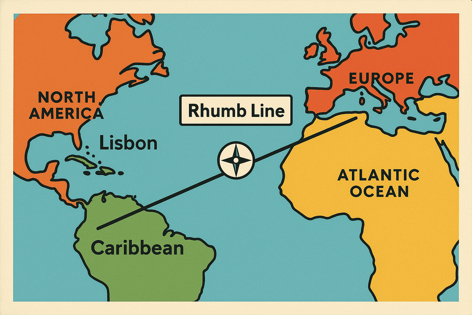
- Route: Lisbon, Portugal to Salvador, Brazil.
- Great-Circle Path: The shortest route. A ship would have to start by sailing almost due west, gradually turning its heading south-southwest as it crossed the Atlantic. This required the crew to perform complex spherical trigonometry calculations regularly to find their new bearing, a task fraught with potential error on a rolling ship with rudimentary tools.
- Rhumb Line Path: A slightly longer route. The captain could simply point the ship in a constant southwesterly direction. It might add days or even a week to the journey, but its simplicity and reliability were paramount. No complex math, no constant adjustments. Just follow the compass.
In an era without GPS or computers, the trade-off was obvious. A predictable, slightly longer journey was infinitely safer than a shorter, more complex one where a single navigational error could lead to getting lost at sea.
Enter Gerardus Mercator: The Mapmaker’s Solution
This is where the Flemish cartographer Gerardus Mercator comes in. In 1569, he published his groundbreaking world map with a revolutionary property. He mathematically designed his projection so that lines of longitude (meridians) were parallel, rather than converging at the poles. To compensate for the east-west stretching this caused, he progressively stretched the map in the north-south direction as well.
The result is the distortion we all know. But this distortion achieved something magical: it made any rhumb line on Earth appear as a perfectly straight line on his map.
Suddenly, the impossible was possible. A navigator could:
- Find their departure point (e.g., London) and their destination (e.g., Jamestown, Virginia) on the Mercator chart.
- Take a ruler and draw a single straight line connecting them.
- Use a protractor to measure the angle of that line relative to the vertical lines of longitude.
- That angle was their rhumb line course—the single, constant compass bearing they needed to follow for the entire voyage.
The Mercator projection transformed the complex spiral of a rhumb line on a globe into the simplest shape imaginable on paper. It was the ultimate navigational tool, a graphical computer for the pre-digital age.
The Rhumb Line’s Impact on Global Geography
This simple innovation had profound consequences for human geography. The predictability and safety offered by rhumb line navigation supercharged the Age of Discovery. European powers could now establish and maintain reliable, long-distance sea lanes for trade, colonization, and military power.
Think of the great colonial trade networks, like the triangular trade that connected Europe, Africa, and the Americas. The individual legs of these journeys were plotted as rhumb lines. The wealth that flowed into port cities like Amsterdam, Bristol, and Lisbon was carried on ships whose courses were drawn with a ruler on a Mercator chart. While captains still had to account for physical geography—winds like the Trade Winds and ocean currents like the Gulf Stream—the underlying navigational framework was the rhumb line.
The world became more connected, not by the shortest path, but by the simplest path to navigate. The Mercator map and its rhumb lines didn’t just represent the world; they actively shaped its economic and political history.
Are Rhumb Lines Obsolete in the Age of GPS?
Today, with GPS technology, following a great-circle route is trivial. A ship’s computer can make constant, minute adjustments to the rudder, keeping the vessel perfectly on the shortest possible path to save fuel and time. For this reason, modern commercial shipping and aviation rely on great-circle navigation.
But the rhumb line is far from dead. For shorter distances, the difference in length between a rhumb line and a great-circle route is negligible, and the rhumb line is still easier to steer manually. Private sailors, fishing vessels, and coastal navigators still use it constantly.
More importantly, the Mercator projection remains the absolute standard for nautical charts. Why? Because when a modern navigator plots a course on their chart—even if it’s a series of short rhumb line segments that approximate a great circle—they need that course to appear as a straight line. The fundamental genius of Mercator’s design is as relevant to a sailor today as it was in the 16th century.
So the next time you look at that distorted world map, try to see it through the eyes of a mariner. Look past the oversized Greenland and Antarctica. Instead, see the invisible grid of straight lines that connect our world—the simple, elegant rhumb lines that gave humanity the confidence to cross the oceans.