Imagine walking along a golden ribbon of sand, with the sea lapping at both sides, leading you from the mainland directly to the shores of a mysterious island. This isn’t a scene from a fantasy novel; it’s a real and spectacular geographical phenomenon known as a tombolo. These natural land bridges are not man-made causeways but are sculpted entirely by the patient, persistent power of the ocean’s waves. They are a perfect testament to the dynamic and ever-changing nature of our coastlines.
What Exactly is a Tombolo?
In the world of coastal geomorphology, a tombolo is a depositional landform—meaning it’s made of material deposited by natural forces. Specifically, it’s a bar of sand or shingle that connects an island to the mainland. Once this connection is complete, the island is referred to as a “tied island.”
Tombolos can vary dramatically in size and composition. Some are slender, sandy spits that are only visible at low tide, while others are massive, permanent features composed of coarse shingle and pebbles, wide enough to support roads and buildings. Their existence is a delicate balancing act, a physical manifestation of the ongoing conversation between land, sea, and weather.
The Dance of Waves: How Tombolos Form
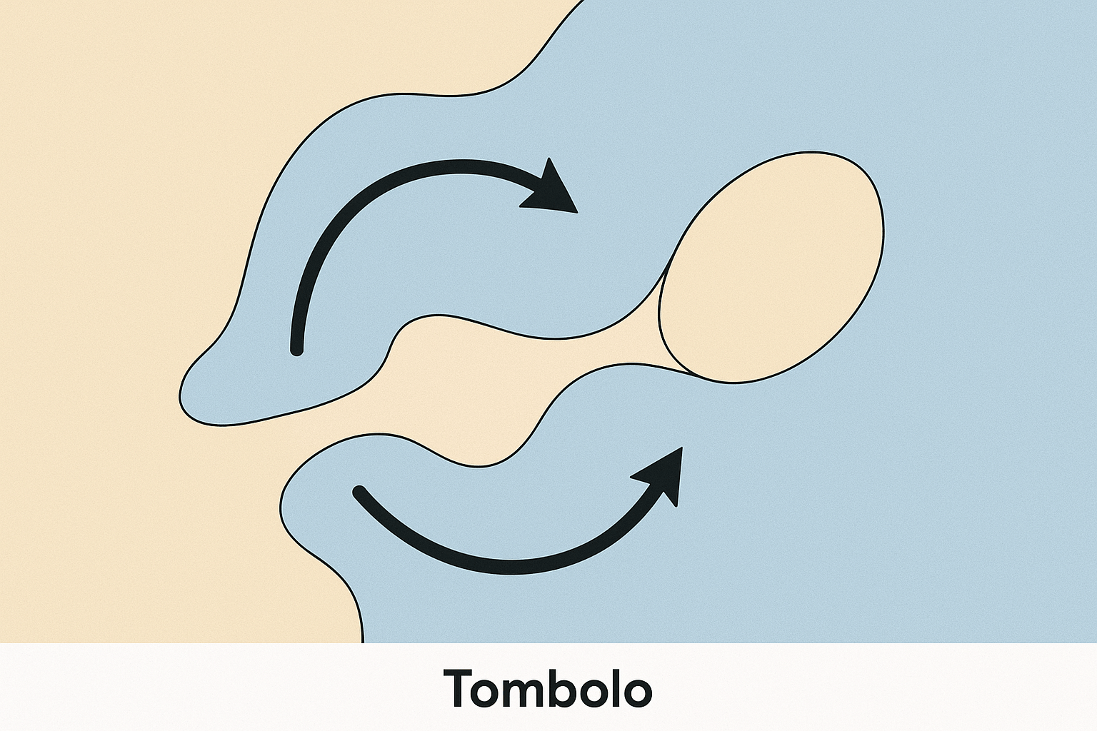
The creation of a tombolo is a fascinating process driven by two key coastal mechanisms: longshore drift and wave refraction. It’s a slow, deliberate dance that can take thousands of years.
Step 1: Longshore Drift Sets the Stage
First, we need a supply of sediment. This is where longshore drift comes in. When waves approach a coastline at an angle (driven by the prevailing wind), the swash (the water running up the beach) carries sand and shingle up the beach at that same angle. However, the backwash (the water running back down) flows straight back to the sea, perpendicular to the coastline, due to gravity. This continuous zig-zag movement, like a tiny coastal conveyor belt, transports vast quantities of sediment along the shore.
Step 2: Wave Refraction Creates a Shelter
Now, picture an island sitting a short distance from this coast. As deep-water waves approach the island, they begin to “feel” the shallower seabed around it. This causes the waves to slow down and bend, a process called wave refraction. The wave front wraps around the island, concentrating its energy on the headlands facing the open sea.
Crucially, this refraction creates a “wave shadow” or a zone of calm, low-energy water in the lee of the island—the side facing the mainland. The waves that have bent around both sides of the island converge in this sheltered zone, their energy largely spent.
Step 3: Deposition Builds the Bridge
This is where the magic happens. The longshore drift current, carrying its load of sediment along the mainland coast, meets this area of calm water behind the island. As the refracted waves converge and the water movement slows, they lose the energy required to carry their sediment load. They drop the sand and shingle they were transporting.
Over time, this deposition builds up, forming a spit that grows from the mainland out towards the island. Sometimes, a similar spit may grow from the island towards the mainland. Eventually, the two connect, or one grows all the way across, forming the tombolo and officially tying the island to the coast.
A Global Showcase: Famous Tombolos Around the World
Tombolos can be found on coastlines across the globe, each with its own unique character and story. Here are some of the most remarkable examples:
St. Ninian’s Isle, Shetland, Scotland
Arguably one of the most perfect examples in Europe, the tombolo connecting St. Ninian’s Isle to the Shetland mainland is a breathtaking sight. It is a stunning 500-metre-long sandy beach, known locally as an ayre. What makes it special is its active and pristine nature; it’s a double-sided beach in perfect equilibrium with the sea. This site also has a rich human geography. In 1958, a local schoolboy discovered the St. Ninian’s Isle Treasure, a trove of 8th-century Pictish silver, buried beneath the floor of the ruined chapel on the tied island—a treasure hidden for centuries, linked to the mainland by this wave-built bridge.
Mont-Saint-Michel, Normandy, France
This iconic UNESCO World Heritage site is a powerful example of the interplay between natural processes and human history. For centuries, Mont-Saint-Michel was a true tidal island, with a slender, natural tombolo that was often submerged during high tides, adding to the abbey’s defensive and mystical appeal. Over time, siltation and the construction of a raised, permanent causeway in the 19th century solidified its connection to the mainland, threatening its maritime character. In a massive recent engineering project, the old causeway was replaced by a light bridge, designed to allow the tide to flow freely again, flush out the accumulated silt, and restore Mont-Saint-Michel’s spectacular island identity.
Chesil Beach, Dorset, England
Chesil Beach is a geological marvel and a more complex type of tombolo. This colossal 18-mile-long, 15-metre-high barrier of shingle connects the Isle of Portland to the mainland at Abbotsbury. Its formation is more complicated than a classic tombolo, likely involving rising sea levels after the last Ice Age pushing a barrier beach onshore. Today, it stands as one of the world’s most impressive shingle structures, separating the Fleet Lagoon from the open sea.
Barrenjoey Head, New South Wales, Australia
On the other side of the world, Barrenjoey Headland, crowned by its historic lighthouse, is a tied island. It is connected to the popular Palm Beach peninsula in Sydney by a magnificent sandy tombolo. This location beautifully illustrates the tombolo formation process, with the headland providing the necessary shelter for sand to accumulate and form a stable land bridge between the Pacific Ocean and the calmer waters of Pittwater.
The Fragile Nature of Tombolos
Despite their sometimes-imposing size, tombolos are delicate and dynamic landforms. They exist in a fragile balance, governed by the supply of sediment and prevailing wave conditions. Their existence is threatened by both natural and human factors.
Powerful storms can breach or even completely wash away a tombolo overnight. Furthermore, climate change poses a significant threat. Rising sea levels could permanently submerge lower-lying tombolos, while changes in storm patterns could alter the wave dynamics that created them in the first place.
Human interference, such as the construction of breakwaters, groynes, or harbors along the coast, can disrupt the vital flow of longshore drift. By trapping sediment, these structures can “starve” a tombolo further down the coast, leading to its erosion and eventual disappearance.
These beautiful land bridges are more than just coastal curiosities; they are sensitive indicators of coastal health. They remind us that our world’s coastlines are not static lines on a map, but living, breathing systems forged by the awesome and intricate power of the sea.